
Science Systems & Equipment
We support the development of transformative technologies that scale and enhance the ability for scientific research and exploration in the Ocean.



We support the development of transformative technologies that scale and enhance the ability for scientific research and exploration in the Ocean.

Technology drives discovery at Schmidt Ocean Institute, transforming how we explore and understand the ocean. From high-resolution mapping systems to robotic platforms and integrated data tools, these innovations enable precise observation and analysis of the ocean environment.
Designed for flexibility, RV Falkor (too) can support a wide range of scientific objectives, adapting its technologies and systems to meet the needs of each science expedition. By making these capabilities available to the scientific community, we accelerate discovery and foster global collaboration in ocean science.
R/V Falkor (too) was designed to maximize sonar performance through specialized hull features that reduce acoustic interference in challenging sea states. The vessel’s large sonar gondola, integrated during the original refit, lowers the sonar arrays below the primary hull-water interface to shield them from bubble sweep and turbulence, improving data quality in rough conditions. After several years of operational experience, the vessel was further enhanced in 2025 with the addition of the “Science Bow,” a modification that changed the shape of the bow, significantly reducing bubble entrainment along the hull in heavy weather. Together, these design features expand the range of sea states in which high-quality mapping can be conducted, increasing efficiency and effective use of ship time.
Multibeam sonars create detailed imagery of the seafloor by sending out fans of sound pulses beneath the ship. By calculating the time it takes for each pulse to bounce back, the system determines the depth at many points across the seafloor, building a three-dimensional map below the ship nearly instantaneously. Different multibeam system designs allow for mapping at different depths - some provide extremely high detail in shallow water, while others can reach much deeper with broader coverage. R/V Falkor (too)’s multibeam sonars work together across this range, delivering high-resolution seafloor mapping wherever the ship operates, from shallow coastlines to the deepest ocean trenches.

Kongsberg EM2040-04
Sonar: Multibeam
Beamwidth: 0.4° Tx with 0.75° Rx
Depth Range: < 1 m - 635 m
Operating Frequency: 200 - 700 kHz
Swath Width: Up to 170°
Receiver Beams: 1024 beams

Kongsberg EM712
Sonar: Multibeam
Beamwidth: 0.25° x 0.5°, full performance
Depth Range: 3 m - 3,600 m
Operating Frequency: 40 - 100 kHz
Swath Width: Up to 5.5 times the depth
Receiver Beams: 1600 beams

Kongsberg EM124
Sonar: Multibeam
Beamwidth: 0.5° x 1°
Depth Range: 20 m - 11,000 m
Nominal Frequency: 12 kHz
Operating Frequency: 10.5 - 13.5 kHz
Swath Width: Up to 6 times the depth
Receiver Beams: 1600 beams
Acoustic Doppler Current Profilers (ADCPs) measure the speed and direction of water currents by sending sound waves into the water and listening to how particles in the water scatter the sound. By analyzing the change in frequency of the returned echoes (the Doppler shift), the system can calculate how fast and in what direction the water is moving at different depths.
Shallow ADCPs capture detailed currents near the surface, while deeper systems provide broader coverage at greater depths. R/V Falkor (too) carries both, recording currents at a depth range from just below the ship down to 1,000 meters, providing a complete picture of ocean circulation from the upper water column to the upper deep sea.

Teledyne WH300 and Simard EC-150
Sonar: ADCP
Frequency: 300 kHz (wh300) and 150 kHz (ec150)
Profiling Range: 154 m (wh300)
Max Bottom Tracking: 253 m (wh300) and 400 m (ec150)
Velocity Range: + 5 m/s (wh300)
Velocity Accuracy: + 0.5 cm/s (wh300)

Teledyne RDI OS38
Sonar: ADCP
Frequency: 38 kHz
Max Profiling Range: >1,000 m
Max Bottom Tracking: 1,700 m
Velocity Range: + 7 m/s
Velocity Accuracy: + 0.5 cm/s
A Sub-bottom Profiler (SBP), uses low-frequency sound pulses to penetrate beneath the seafloor and probe the underlying sediment and rock layers. As the pulses travel downward, each boundary between layers reflects distinguishable signatures of the sound back to the ship. By analyzing the timing and strength of these reflections, the system produces a detailed cross-section of subsurface layers and can provide information on their composition, such as distinguishing between soft sediments and harder consolidated layers.
On R/V Falkor (too), the SBP29 is used across the full depth range of the ocean, from shallow water to the deepest trenches. It is commonly used to characterize seafloor substrate and sediment structure, and can also reveal subsurface features such as methane pockets beneath the seafloor. The system can be synchronized to ping alongside the multibeams during acoustic surveys, allowing sub-seafloor information to be collected concurrently with seafloor mapping.

Kongsberg SBP 29
Sonar: Sub Bottom Profiler
Degree: 3° x 3°
Depth Range: 1 m - 11,000 m
Max Penetration: >200 m
Operating Frequency: 2 - 9 kHz
Pulse Length: 2 to 100 ms
Single-beam depth sounders measure water depth by transmitting a focused pulse of sound directly beneath the ship and timing how long it takes for the echo to return from the seafloor. Using the known speed of sound in seawater, this travel time is converted into an accurate depth measurement at a single point directly below the vessel.
R/V Falkor (too) primarily relies on its multibeam systems for comprehensive seafloor mapping. The depth sounder serves as a backup depth-measurement system, providing reliable, straightforward depth data along the ship’s trackline when needed to support navigation and ongoing science operations.

Kongsberg EA640
Sonar: Single Beam Echosounder
Frequency: 12 kHz
Depth Range: 1 m - 11,000 m
Hydrophones monitor underwater sound by measuring the presence and intensity of sound across a range of frequencies. Rather than recording audio, it analyzes the frequency of the sound field, allowing specific sound signatures to be identified.
On RV Falkor (too), this capability supports the detection and study of marine life that produces characteristic sounds. Operationally, the system is used to monitor the ship’s acoustic environment, track noise generated by the vessel and other onboard sonar systems, and help explain interference or noise observed in sonar data.

Kongsberg EA440
Sonar: Hydrophone
Frequency: 10 - 90 kHz
Sonars determine distance, depth, and position by measuring how long it takes for a sound pulse to travel through the water, reflect off a target, and return to the sensor. Accurate sound speed measurements are critical to sonar operation, as even small errors in sound speed can result in significant errors in range, depth, and angle calculations.
On R/V Falkor (too), sound speed is continuously monitored and updated using multiple complementary methods to ensure the highest data quality. A live sound speed sensor at the sonar faces provides real-time measurements for beam steering. Expendable probes (XBTs) supply temperature profiles that can be referenced to sound speed, offering regular updates to water column conditions in the upper water column, without interrupting other operations. In addition, sound speed profiles derived from CTD and ROV downcasts and upcasts are routinely applied, ensuring the sonar systems use the most current and representative sound speed information available.

Valeport Mini SVS
Sonar: Sound Velocity
Frequency: 2.5 MHz
Range: 1375 - 1900 m/s
Accuracy: 0.019 m/s
Resolution: 0.001 m/s

Lockheed Martin XBT
Probe: Deep Blue
Depth Range: 760 m
Vertical Resolution: 65 cm
Max Ship Speed: 20 knots

CTD Seabird 911 System
The Sea-Bird SBE 911plus CTD derives sound velocity using high-accuracy measurements from dual SBE 3plus temperature sensors, dual SBE 4C conductivity sensors, and a Digiquartz pressure sensor, calculating full-depth sound speed profiles for precise acoustic timing and correction.
ROV installed Seabird SBE49 and Valeport uvSVX
On the ROV, sound velocity profiles are obtained using a combination of a Sea-Bird SBE-49 FastCAT CTD, which derives sound speed from high-accuracy temperature, conductivity, and pressure measurements, and a Valeport uvSVX, which directly measures sound velocity using time-of-flight technology, providing complementary, high-resolution sound speed data throughout the water column.
The EK80 echosounder uses sound to detect and characterize targets in the water column, such as fish, zooplankton, and other scattering organisms. By transmitting sound pulses and measuring the strength and timing of the echoes that return, the system can determine the depth, distribution, and relative abundance of organisms between the surface and the seafloor.
The EK80 operates across multiple acoustic frequencies (18, 38, 70, 120, 200, and 333 kHz), with each frequency interacting differently with organisms of varying sizes and compositions. Lower frequencies penetrate deeper and are better suited for detecting larger targets, while higher frequencies provide finer detail and improved sensitivity to smaller organisms. Using multiple frequencies together allows researchers to distinguish between different types of marine life and better interpret the structure of the midwater ecosystem.

Simrad EK80
W/ EC150-3C ADCP
Sonar: Mid-water echosounder
Frequency Range: 18, 38, 70, 120, 200, and 333 kHz
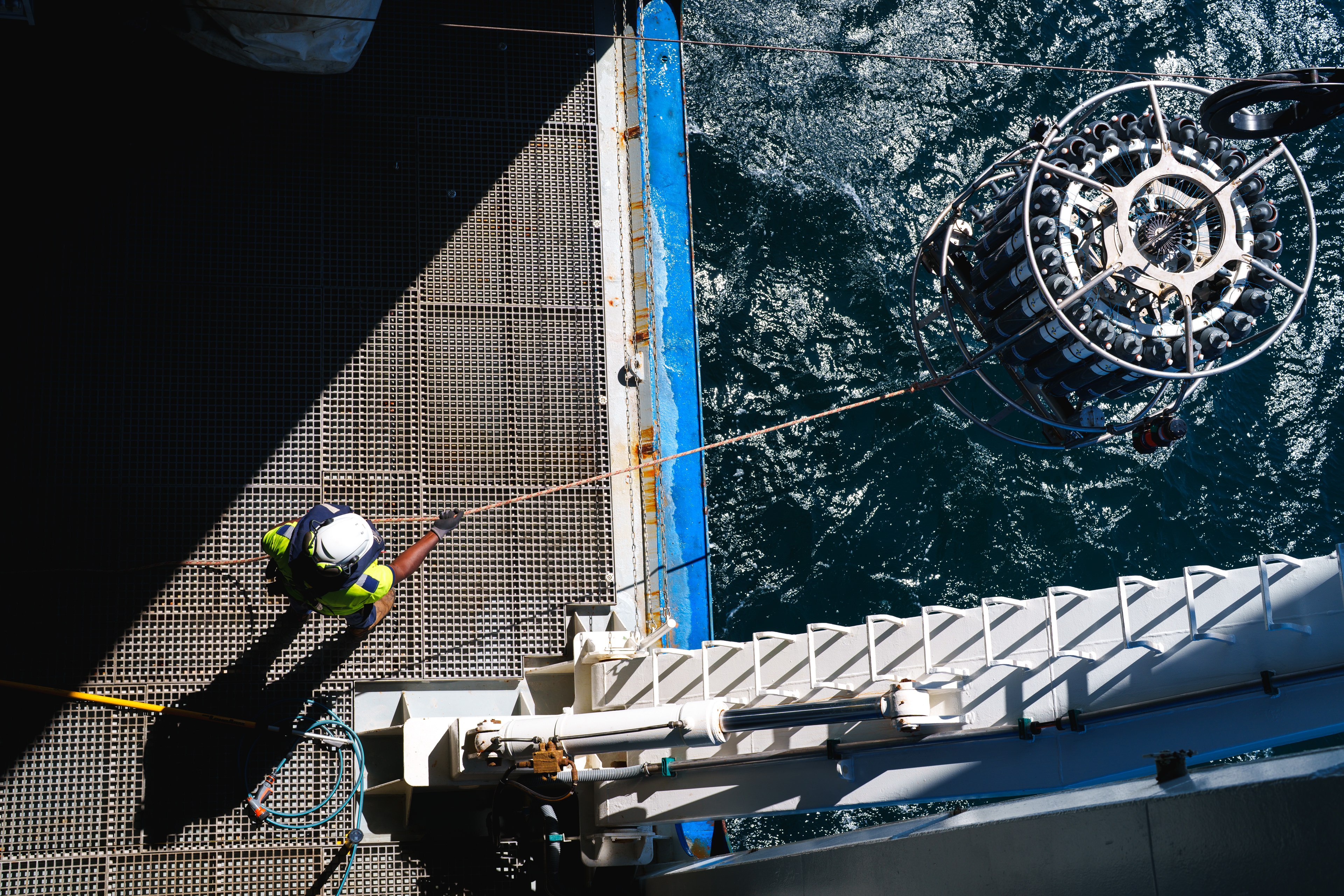
R/V Falkor (too) carries a Sea-Bird Electronics 911plus CTD system mounted on a rosette equipped with twenty-four 12-liter Niskin bottles for discrete water sampling. The system is configured with dual sensors for core measurements, providing redundancy and high-resolution data. A USBL beacon is always installed on the CTD rosette, allowing CTD data and water samples to be precisely geolocated and tied to specific locations on the seafloor or within the water column.
CTD sensor configurations are customized for each cruise, allowing the system to be tailored to specific scientific objectives, but a standard configuration is described below.
Sea-Bird SBE 3plus temperature sensor
Configuration: dual SBE 3plus temperature sensors (primary and secondary)
Depth Rating: 6,800 m or 10,500 m
Measurement Range: -5 to +35 °C
Accuracy: ± 0.001 °C
Resolution: 0.0003 °C at 24 samples/sec
Sea-Bird SBE 4C conductivity sensor
Configuration: dual SBE 4C sensors (primary and secondary)
Depth Rating: 6,800 m or 10,500 m
Measurement Range: 0.0 to 7.0 S/m
Accuracy: ± 0.0003 S/m
Resolution: 0.00004 S/m at 24 samples/sec
Sea-Bird SBE 43 Dissolved Oxygen Sensor
Configuration: dual SBE 43 sensors (primary and secondary)
Depth Rating: 7,000 m
Measurement Range: 120% of surface saturation in all natural waters (fresh and salt)
Accuracy: ± 2% of saturation
Wetlabs FLNTU(RT)D
Configuration: Combined fluorometer and turbidity sensor
Depth Rating: 6,000 m
Florescence Wavelength: 470/695 nm
Florescence Range: 0–50 µg/l Chl
Turbidity Wavelength: 700 nm
Turbidity Range: 0-25 NTU
Wetlabs C-Star Transmissometer
Configuration: single sensor
Depth Rating: 6,000 m
Path Length: 25 cm
Wavelength: 657 nm (red)
Biospherical Instruments QSP-2350 underwater PAR sensor
Configuration: single sensor
Depth Rating: 2,000 m
Stability of Dark Reading: < 0.003 µE m‐2 sec‐1 (tested between 0 to 50 °C)
Valeport VA500 altimeter
Configuration: single sensor
Depth Rating: 6,000 m
Frequency: 500 kHz
Range: 0.1 m - 100 m
Resolution: 1 mm
Ocean Test Equipment Niskin Bottles
Configuration: 24 non-metallic free-flushing water sampling bottles with Sea-Bird mounting hardware.
Depth Rating: corresponds to SBE 32, either 6,800 m or 10,500 m.
Water Capacity: 12 L bottles
To support a wide variety of research, R/V Falkor (too) is equipped with multiple science water systems and laboratory taps, each tailored for specific experimental and analytical needs, as well as a suite of underway seawater sensors that operate continuously to collect essential seawater data from anywhere RV Falkor (too) transits.

Sea-Bird SBE 45 TSG with SBE 38
Uses an intake temperature probe and an internal conductivity and temperature sensor to continuously measure surface seawater temperature and salinity while underway.
Measurement Type: Internal Temperature, External Temperature, Conductivity, Salinity, and Sound Velocity
Measurement Range: -5 to 35 °C; 0 to 7 S/m
Accuracy: ± 0.001 °C (sbe38); ± 0.002 °C (sbe45); ± 0.0003 S/m
Resolution: 0.0003 °C (sbe38); 0.0001 °C (sbe45); 0.00001 S/m
WET Labs C-Star
Continuously measures how much light is transmitted through seawater to quantify particle concentration and water clarity of the water.
Measurement Type: Beam Attenuation
Configuration: 25 cm path length, 650 nm red wavelength
Temperature Range: 0 - 40 oC
Temperature Error: 0.02 % F.S./ oC
Long Term Stability: 0.03 % F.S./ oC
WET Labs ECO FL
Continuously measures chlorophyll fluorescence in surface seawater, providing a real-time proxy for phytoplankton biomass while the ship is underway.
Measurement Type: Fluorescence
Configuration: chlorophyll-a, fDOM, uranine, rhodamine, and
phycocyanin and phycoerythrin
Sunburst AFT pH
Continuously measures the pH (total hydrogen ion activity) of seawater using a spectrophotometric indicator method, providing continuous observations of surface water acidity while underway.
Measurement Type: pH
Range: 7 -9 pH
Accuracy: +/- 0.003 pH units
Precision: <0.001 pH units
GO 8050 Automated Flowing pCO2 Measuring System
Continuously measures the partial pressure of carbon dioxide (pCO₂) in both seawater and the atmosphere while the ship is underway, which is essential for studying air-sea gas exchange, understanding ocean carbon uptake, and monitoring the ocean’s role in regulating global climate.
Configuration: Dry and wet box, with seawater and atmospheric air inputs.
Accuracy: ±2 µatm for seawater and 0.2 µatm for atmosphere
R/V Falkor (too) provides an uncontaminated seawater system designed specifically for scientific use. Seawater is drawn from an intake located approximately 5.3 meters below the waterline on the port bow, minimizing contamination from the ship’s hull and surface influences. The intake passes through a coarse strainer to protect pumps from large debris before being distributed throughout the vessel.
The system is configured as two independent plumbing circuits, allowing scientists to operate duplicate sensors or maintain redundant seawater supplies when required. This design supports continuous flow to scientific instruments while providing flexibility for cruise-specific needs.

The incubator seawater system is a dedicated, high-flow pumped seawater supply intended to support deck-based incubators and experiments requiring large volumes of flowing seawater. This system operates independently from the uncontaminated seawater system, ensuring that incubator use does not impact flow rates or data quality for continuously running seawater sensors utilizing the uncontaminated system.

The chilled seawater system supplies temperature-controlled seawater by routing intake seawater through a chiller to produce water as cold as 4 °C. This allows for laboratory seawater to closely match conditions experienced by many deep-sea organisms.

The plastic-free seawater system is designed without plastic components in the wetted flow path, allowing seawater to be supplied without introducing plastic contamination. This plastic-free seawater feed is available in the Seawater Lab.


R/V Falkor (too) operates a comprehensive, underway meteorological system that continuously records atmospheric and environmental conditions throughout each voyage. This data is logged onboard for scientific use and is also transmitted in near real time to support broader weather and climate modeling efforts, including SAMOS (Shipboard Automated Meteorological and Oceanographic System) and NOAA VOS (Voluntary Marine Observations). Primary meteorological sensors are mounted on the foremast to ensure exposure to clean, undisturbed air away from ship exhaust and turbulence, while additional weather and wind sensors positioned around the vessel help account for airflow effects caused by the ship’s superstructure, resulting in the most accurate and representative measurements possible.
Gill MaxiMet Marine GMX560
Installed at multiple locations around the vessel to measure air temperature, humidity, pressure, and wind, providing lower-resolution but spatially distributed weather observations that help compare and validate the ship’s primary meteorological sensors.
Measurement Types: wind speed and direction; air pressure and temperature; dewpoint and relative humidity
Range: 0 - 60 m/s (wind speed), 0-360 ° (wind direction), -40 °C to +70 °C with heating (air temperature), 0-100 % (relative humidity), 300 to 1250 hPa (pressure)
Resolution: 0.01 m/s (wind speed), 1 ° (wind direction), 0.1 °C (air temperature) 1 % (relative humidity), 0.1 hPa (pressure)
Paroscientific Met4
Provides high-accuracy measurements of air temperature, humidity, and atmospheric pressure, delivering reliable reference atmospheric data that support weather monitoring, sensor validation, and air–sea interaction studies.
Measurement Types: air pressure, air temperature, relative humidity
Range: 500 to 1100 hPa (pressure), -50 °C to +60 °C (temperature), 0 to 100 % (humidity)
Accuracy: better than ±0.08 hPa over full range (pressure), better than ±0.5 °C (temperature), better than ±2 % RH at 25 °C (humidity)
Resolution: better than 0.001 hPa (pressure), better than 0.01 °C (temperature)
Gill Windsonic anemometer
Measures wind speed and direction with high temporal resolution, supplying accurate wind data critical for ship operations and air–sea interaction studies.
Measurement Types: relative wind speed and direction, with true wind speed and direction calculated onboard
Range: 0 - 60 m/s (wind speed), 0 - 360° (wind direction)
Accuracy: ±2 % @12 m/s (wind speed), ±2 ° @12 m/s (wind direction)
Resolution: 0.01 m/s (wind speed), 1 ° (wind direction)
Biospherical Instruments QSR 2200
Measures scalar irradiance from sunlight with a photosynthetically active radiation (PAR) response, quantifying the amount of sunlight available to support marine photosynthesis at the ocean surface.
Measurement Type: PAR irradiance
Range: 0.000014 to 0.5 uE/(cm^2s)
Accuracy: ±5 % of reading, equivalent to ±100 µE under full sunlight (~2000 µE)
Resolution: 0.1 uE/(cm^2s)

OSi APG-815 Optical Rain Gauge
Measures precipitation rate and accumulation by detecting raindrops as they pass through a laser beam, providing reliable rainfall data.
Measurement Types: precipitation rate, precipitation accumulation, precipitation type
Range: 0.001 mm/hr (rate), 0.001 - 999.999 mm/hr (accumulation)
Accuracy: 5 % (rate and accumulation)
Resolution: 0.001 mm (rate and accumulation)
Remotely Operated Vehicles (ROVs) extend human presence into the deep ocean, allowing scientists to observe, sample, and interact with environments that are otherwise inaccessible, while maintaining precise control and real-time data return from the surface.
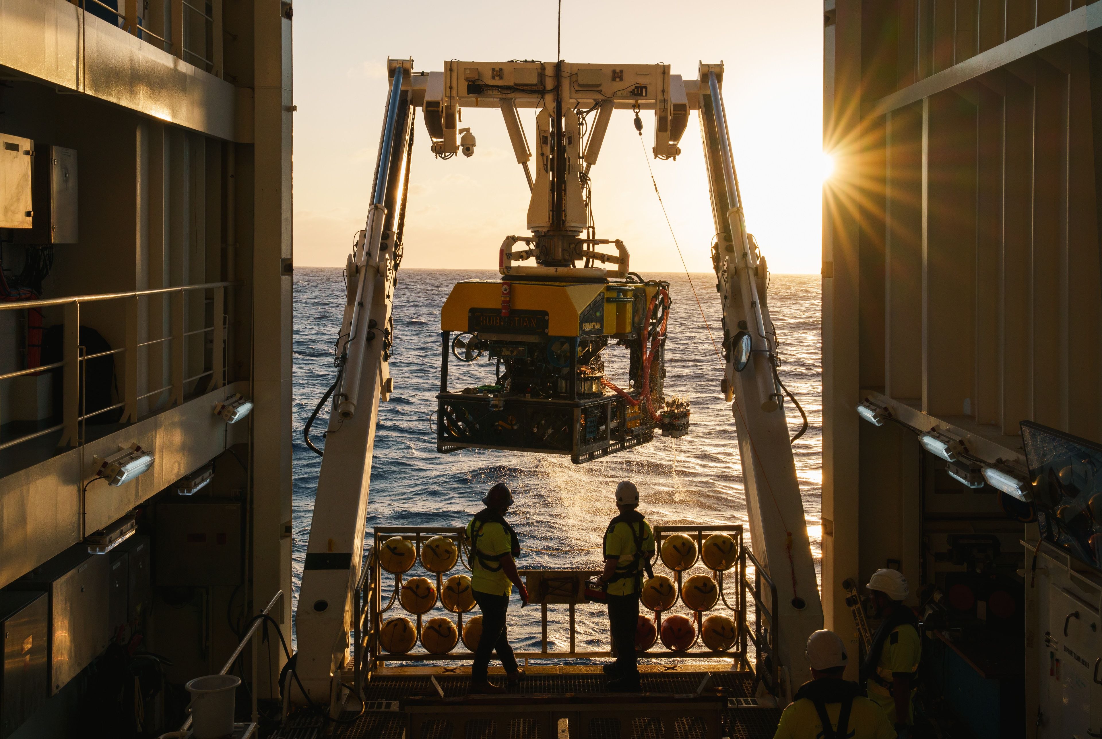
ROV SuBastian is depth-rated to 4,500 meters, supports a wide range of subsea research activities, including collection of geological and biological samples, reconnaissance and seafloor mapping, equipment deployment and recovery, and seawater characterization using a standard suite of sensors. The vehicle also enables telepresence and visually immersive remote operations through an ultra-high-definition pan-tilt-zoom camera system for scientific video acquisition. Additional sensors and instruments can be integrated to meet the specific needs of each cruise.
ROV SuBastian uses a SPRINT inertial navigation system (INS) that combines multiple data sources to determine the vehicle’s position underwater.
Inputs include DVL altitude measurements, depth from pressure sensors, gyrocompass heading, and USBL acoustic tracking. The ROV carries two acoustic beacons that provide ROV position and depth information to the ship, which is fed into the INS. These inputs are fused in real time to produce a continuously updated best-estimate solution of the vehicle’s location throughout each dive.


Collected samples can be stored in a rock box for larger rocks, tools, and nets; a bio box for animals; or a coral quiver for coral and small samples. Niskin bottles are also available for collecting discrete water samples during a dive.

ROV SuBastian is equipped with two Schilling Titan 4 arms that can be operated from Mission Control with exceptional precision. The arms support a range of interchangeable tools for collecting rocks, corals, biological specimens, and equipment, along with specialized samplers such as push cores, sampling nets, and a suction sampler for gently collecting animals.
ROV SuBastian’s camera and lighting systems provide high-resolution imagery and adaptable illumination, allowing scientists to document observations, sampling, and transects clearly across a wide range of depths and operating conditions.
Two primary cameras support scientific operations on ROV SuBastian. A 4K science camera, mounted on a pan-and-tilt with high-resolution zoom, is continuously recorded in 4K to capture detailed observations, sampling, and transects. A situational camera, used primarily for piloting, is also recorded in HD and provided to scientists to offer an additional perspective during dives. Several additional HD and SD cameras supply supporting views for pilot situational awareness and vehicle monitoring.
SULIS Subsea Z70, 4k
DSPL FlexLink HD Multi SeaCam
ROV SuBastian is equipped with multiple lighting systems positioned around the vehicle to optimize imagery and illuminate the surrounding environment at depth. Light placement and intensity can be adjusted in real time during a dive, allowing the team to tailor illumination for different conditions such as midwater observations or seafloor sampling.

Live streaming ROV dives is central to Schmidt Ocean Institute’s mission, enabling real-time collaboration and global outreach by bringing deep-sea exploration and discovery directly to scientists, educators, and the public worldwide.
Almost every ROV dive is streamed live in HD, with the primary science video overlaid with synchronized data including time, depth, CTD, and oxygen measurements. This live stream allows scientists on shore and members of the public to observe dives in real time and interact directly with the science team in Mission Control. Telepresence is a core part of ROV operations, extending the reach of each dive and bringing the deep sea to the surface for a global audience.

Autonomous Underwater Vehicles (AUVs) extend scientific exploration across large areas of the ocean by operating independently of the ship, collecting high-resolution mapping and environmental data in deep and remote regions without the need for real-time human control.
Depth Rating: 0 - 6000m
Vehicle Speed: 2 - 5 knots
Endurance: 72 hrs full payload
Weight (air): 2200 kg
Weight (water): neutral
Length: 6.6 m
Material: Carbon Fiber and Syntactic Foam

The AUV is powered by a large lithium-ion battery system that supports long-duration missions and drives an efficient electric propulsion system capable of speeds up to 5 knots. With independently controlled rudders and terrain-aware control, the vehicle can maneuver precisely over complex seafloor topography, including slopes up to 45 degrees, enabling stable and efficient autonomous operations in challenging environments.

The AUV communicates with the ship using Ultra Short Baseline (USBL) acoustic systems while submerged, enabling command updates, health monitoring, and positional tracking throughout a mission. When on the surface, the vehicle transitions to radio, satellite and wifi communications to support launch, recovery, and status reporting, ensuring continuous operator awareness across all phases of operation.

The AUV navigates autonomously using an integrated navigation system that combines inputs from Doppler Velocity Logs (DVL), altimeters, forward-looking sonar, and inertial sensors. Position updates can be refined through acoustic corrections from the ship or by surfacing for GPS fixes, allowing the vehicle to maintain high navigational accuracy over long-duration missions and complex terrain.

The Childlike Empress carries a primary suite of high-resolution mapping and imaging systems designed for detailed seafloor characterization. These include interferometric synthetic aperture sonar (HISAS) for fine-scale bathymetry, multibeam echosounders (EM2040) for broader terrain mapping, and an optical camera system (CathX) for targeted visual documentation of seafloor features and objects.

A dedicated suite of environmental sensors measures key seawater properties along the vehicle’s track, including temperature, conductivity, sound velocity, dissolved oxygen, methane and carbon dioxide concentrations, turbidity, and fluorescence. These measurements provide critical context for interpreting geological, chemical, and biological processes observed during a mission.

All mission data is recorded to a high-capacity, swappable onboard storage system, enabling rapid data offload and turnaround between dives. The vehicle supports in-mission data processing and sensor interpretation, along with post-mission analysis tools that allow scientists to correct navigation data and identify targets from mosaic data.

The AUV is equipped with multiple autonomous safety and recovery features designed to protect the vehicle in extreme or unexpected situations. These include obstacle avoidance and terrain assessment capabilities, as well as redundant emergency systems such as drop weights, flotation deployment, emergency GPS positioning, and backup acoustic beacons to support vehicle recovery if normal operations are compromised.

Subsea landers are platforms that operate independently of the ship, using ballast to remain on the seafloor for extended deployments. At the end of a mission, an acoustic release drops the weight, allowing the lander to return to the surface for recovery. These landers can be outfitted with cameras, traps, pumps, and other instruments to collect time-series observations and samples before being retrieved by the ship.
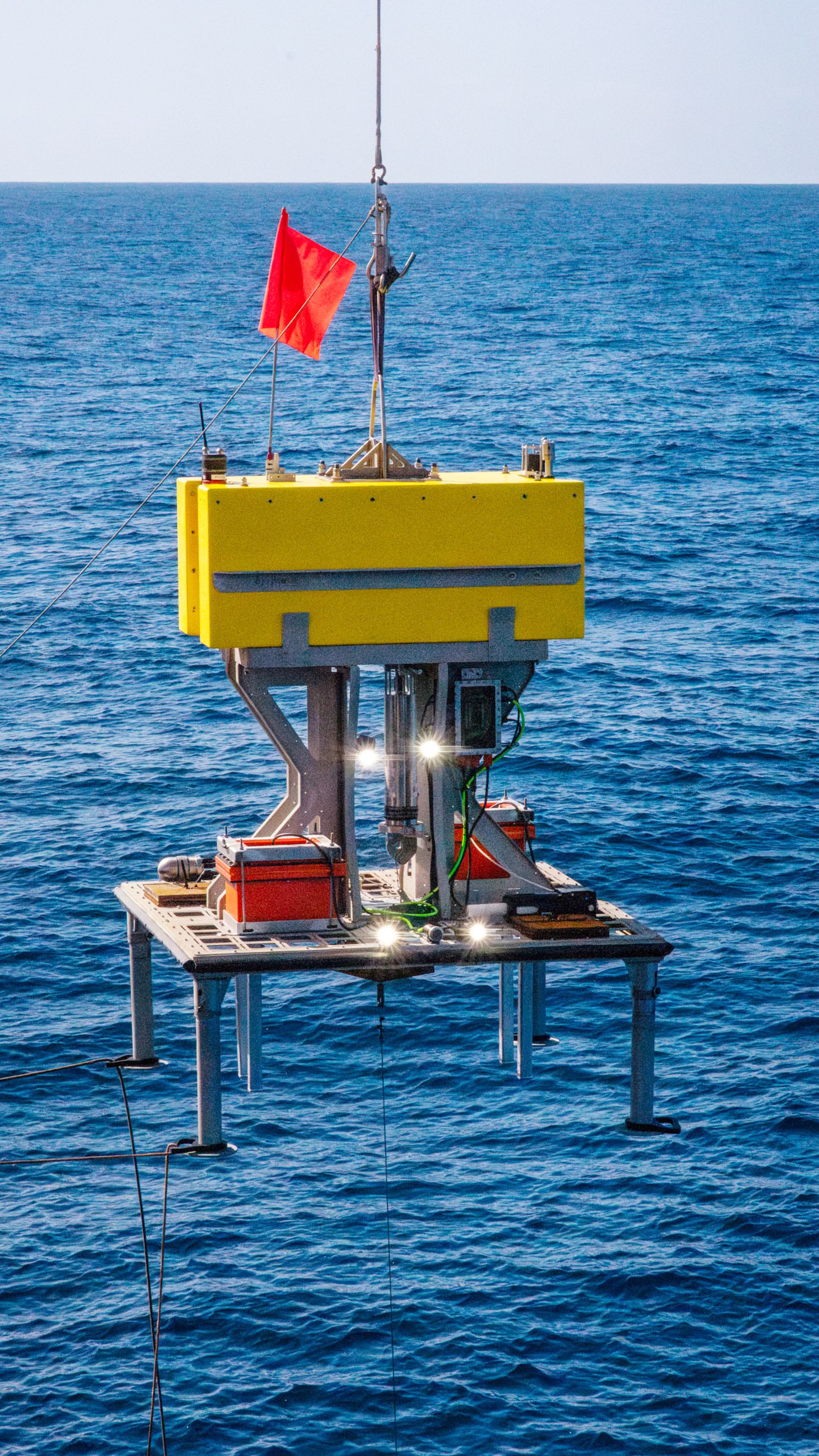
Max Depth: 5,000 m
Platform Dimensions: 183 cm x 183 cm
Payload: up to 250 kg of science equipment
Configuration: Can be fitted with Deep Sea Power and Light SeaBatteries, providing up to 48 VDC to power science sensors, cameras, lights or other equipment.
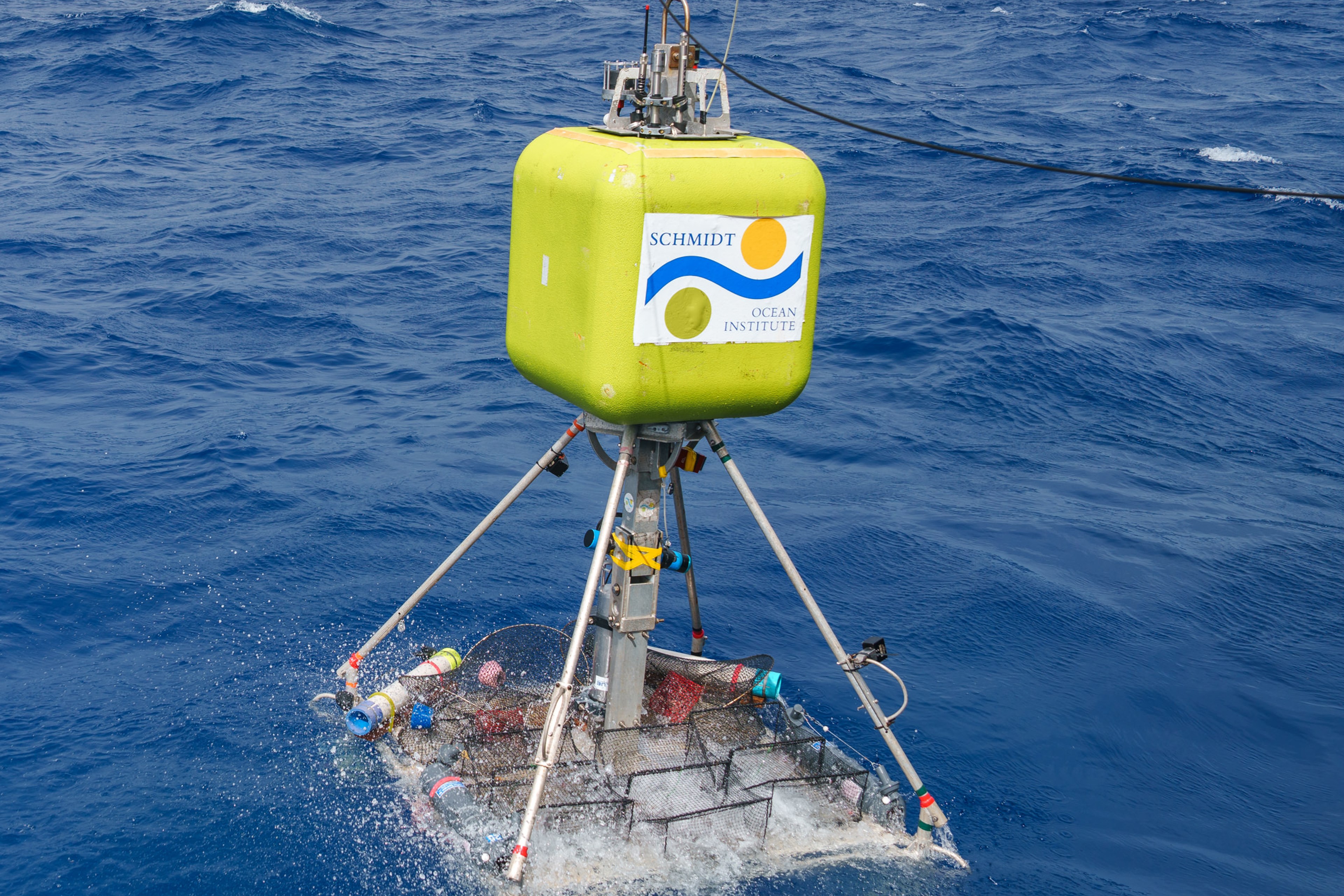
Max Depth: 11,000 m
Platform Dimensions: 173 cm x 196 cm
Payload: 69 kg of science equipment
Configuration: Platform with space for independently powered science equipment, traps, and sensors.

Onboard stereo microscopes provide high-resolution optical imaging for inspection, documentation, and detailed analysis of geological and biological samples.

Leica EZ4 W Stereo Microscope (8×–35×)
A compact stereo microscope providing 8×–35× magnification with an integrated digital camera and built-in illumination, designed for onboard imaging, sample triage, and straightforward documentation of geological and biological specimens.

Leica S Apo Stereo Microscope (10×–80×)
An apochromatic stereo microscope offering 10×–80× magnification, paired with a Flexacam C3 digital camera and LED2500 stand with integrated incident and transmitted LED illumination, enabling high-resolution, color-correct imaging and detailed analysis of fine biological and geological features.
The ship’s science gas distribution system routes gases from aft-deck gas lockers to dedicated lab tap points, while a Honeywell gas monitoring system continuously tracks lab environmental conditions to ensure safe operation.

RV Falkor (too) is equipped with a liquid nitrogen generator producing up to 7 liters per day with 35 liters of internal storage, supplemented by two 50-liter external Dewars (100 liters total) for LN₂ caching.

RV Falkor (too) is equipped with a drying oven, operating from ~10 °C above ambient up to 95 °C with stable temperature control within a few degrees of setpoint; it can be used as a basic incubator for low-temperature applications.

RV Falkor (too) is equipped with three Esco ductless fume hoods (two in the Main Lab, one in the Wet Lab). These hoods do not exhaust externally; instead, they rely on a carbon filter paired with a secondary specialty filter configured for a specific chemical class—typically aldehydes, acids, or VOCs. As ductless hoods depend on filter performance and do not provide continuous breakthrough verification, chemical use must align with the installed filter configuration and its operational constraints.

R/V Falkor (too) is equipped with Starlink antennas that provide high-bandwidth upload and download capabilities, enabling reliable internet connectivity at sea. This system supports continuous ROV Divestreaming, real-time data transfer, cloud-based workflows, and telepresence participation by science teams and collaborators ashore, ensuring reliable communication between ship and shore throughout expeditions.
Schmidt Ocean Institute has implemented a high-performance cloud computing infrastructure to address the challenge of processing and storing massive data volumes at sea. R/V Falkor (too) hosts an onboard HPC cluster mirrored by an equivalent shoreside system located in a US West Coast data center. Each installation consists of five compute nodes interconnected via 10 GbE networking, enabling high-throughput data transfer, parallel processing, and scalable storage. Scientists can configure and deploy computational environments ashore via secure VPN access and migrate active instances to the vessel for at-sea operations, ensuring continuity between shipboard and land-based workflows. The system architecture incorporates three independent firewalls and continuous hardware monitoring across all servers to maintain security, high availability, and operational reliability with minimal downtime.

