



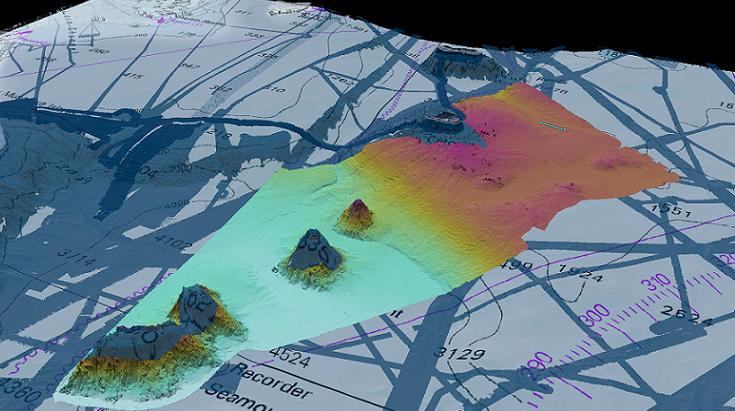

As we start our transit back to the port of Brisbane, we continue collecting seafloor mapping data from the multibeam sonar and magnetic signature data from the towed magnetometer while observing seabirds along the way. But it is time now to reflect on the voyage as a whole and all the scientific data we have collected over the past 30 days.
This voyage's primary focus was mapping new areas of the seafloor to contribute towards The Nippon Foundation-GEBCO Seabed 2030 Project
It is exciting to be the first to “see” what the multibeam sonar reveals on the seafloor as we explore these remote and previously unmapped regions of the ocean. The new multibeam maps reveal the complexity of the deep marine environments. They provide new detail of the volcanic Tasmantid Seamounts
Alongside the seafloor mapping, we undertook a range of opportunistic science activities to make the most of the R/V Falkor being in this region. We collected seafloor magnetic data along several long transit lines using a towed magnetometer to understand the opening of the Tasman Sea Basin. We measured the ocean currents and eddies using an Acoustic Doppler Current Profiler (ADCP)
The science, mapping, and student training will continue on the next voyage on board R/V Falkor that will depart from Brisbane in early February. Dr Helen Bostock will be handing over the on-board science leadership to Dr Derya Güerer
The virtual participation of scientists onshore has allowed the R/V Falkor to continue sailing throughout the COVID-19 pandemic. However, while some scientists are stuck at home participating virtually, the circumstances have provided additional opportunities for local students to get hands-on experience and help young scientists step up and lead voyages - training up the next generation of ocean scientists and leaders. We are incredibly grateful to the Schmidt Ocean Institute for this opportunity and have enjoyed working collaboratively with the marine technicians and ship’s crew.